The last day at Ecocamp in Reykjavik we used the time to get organized for our trip to Greenland. Since we were leaving the truck behind in Iceland, we had to carry enough clothing and supplies with us for two weeks. Taken into account unpredictable weather and food uncertainty. But, I will write about our Greenland adventure in the next chapter.
After returning from Greenland, we had five days left to get from Reykjavik to the ferry port, that is about 800km. We had taken into account possible flight delays from Greenland back to Iceland, due to bad weather cancellations. Luckily, all went well, no real delays and we arrived back at the airport in Reykjavik on schedule, late in the evening.
Leaving the truck behind for two weeks on a large parking lot, with stories of burglaries and vandalism, worried us a lot when we were away. You can imagine how pleased we were, when we found the truck intact, and that also the batteries were still fully charged and the fridge and freezer were running fine.
That night we drove to Grinsvik, the volcano forced abandoned town and camped in the middle of that town. We had a midnight dinner in the truck and wondered how it would be if the volcano would erupt again that night. Still, after a long day of flights from Greenland and all our Greenland impressions still in our minds, we fell in a deep sleep.
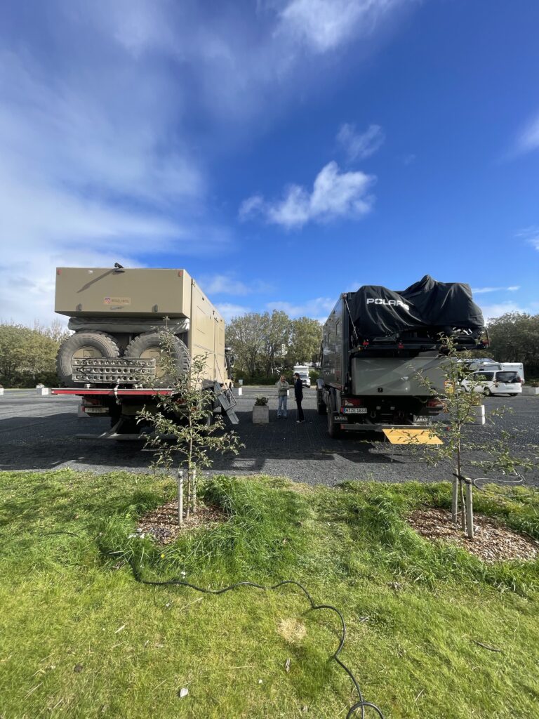
Sebastain was also back in Iceland again after he had left for a short while. We met up at the Ecocamp in Reykjavik the next morning. Again the two Zetros trucks were parked next to each other and we had a nice Sunday breakfast with him in his truck.
After saying goodbye for the last time, we left to drive the last part of the circle around Iceland, towards the ferry port. This part along the east coast coming from the south, is part of the so called Golden Circle. This is a route, where most of Icelands top tourist sites are located. And yes, this is where we found most of the tourists. And although it was already mid September, it was still very busy (we noticed that already during our last visit to Ecocamp, the site was packed).
We passed The Geyser, a fountain of hot water, which occasionally bursts out a large amount of water, part one of the many seismologic activities in Iceland. It was the first natural hot water fountain named liked that and since then, all other hot water fountains in the world are called Geysers. Since no parking was available, we only saw it from a distance and had to move on.
The first big waterfall we passed, the parking was (again) more than full, so we passed that one and followed a gravel road, which quickly had many signs about deep river crossings and that insurance companies of rental cars would not pay for damaged cars, when using this road. Again, that discouraged 98% of the visitors to going any further.
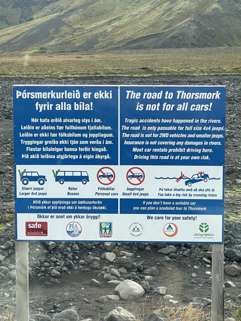

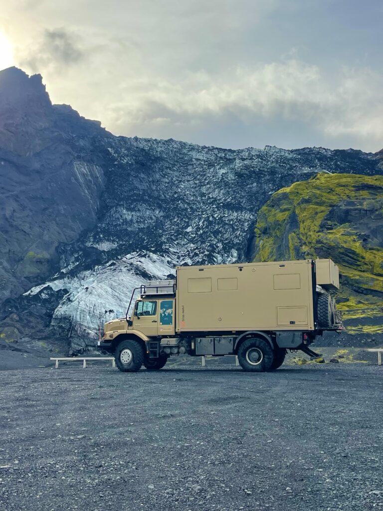
We enterend the area of Posmork, which we admired so much when we flew over it with Jon. Indeed we came across many river crossings, but they were no problem for us. The area is as beautiful from the air as from the ground.. It’s again that green moss on the black mountains, which is so captivating. Along the way we saw an abandoned Dacia rental car, which was pulled out from one of the rivers….some people are hard headed.

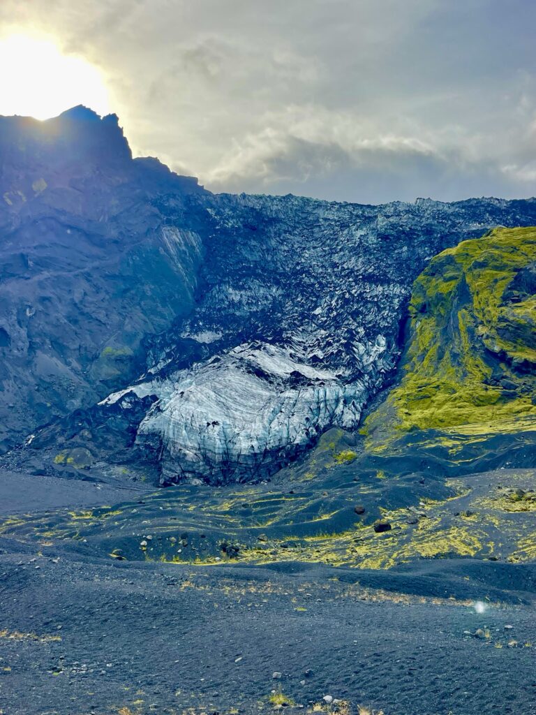
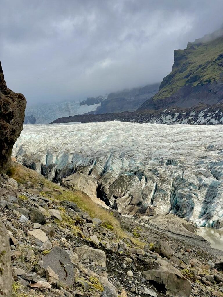
A small road led us to one of the many blackened glaciers, which are part of Icelands largest icecap, the Vatnajokull icecap, which is the 2nd largest icecap (7700km2) of Europe, after the one on Nova Zembla. The black sand and ash on the glacier were again silent reminders of past volcanic eruptions. As said before, the blackening of the ice by the sand and ash reduces the sunlight reflection, causing the ice to melt faster (a dark surface also tends to attract more heat).
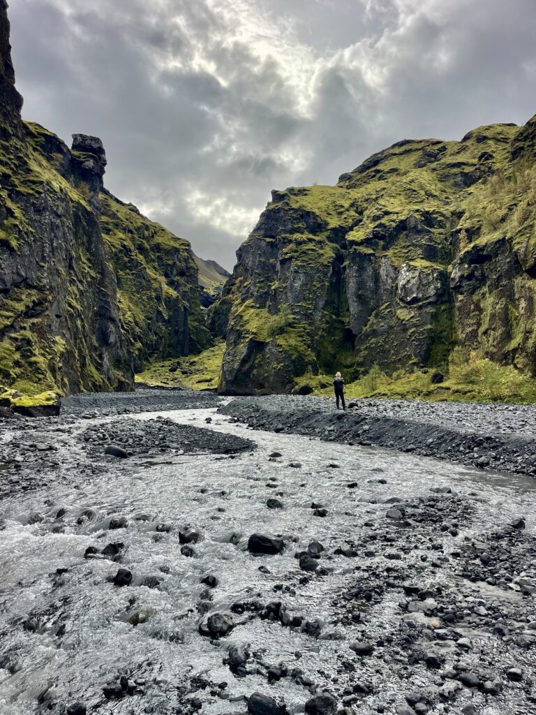
Continuing on the road through the Posmork area, a large canyon filled with large rounded stones, between green covered walls of granite, acted like a distraction of the wide open space the route into Posmork turns out to be. Wandering through the canyon, where the cracking of stones under our feet echoed against the high walls of granite, we felt like entering a large room, where we just opened a door, which closed quickly behind us. Although, no living creatures could be expected here, the feeling was there, that an ancient animal like a dinosaurus could just jump out of a hidden cave at any moment!
There are three remote camps in the Posmork area, which are accessible by special super jeeps or high clearance buses. These are so called base camps, from where visitors can do multi-day hikes. One we had already visited, when landing on the airstrip with Jon. The last one was in the far end of the valley we had driven in that day, passing that glacier and the canyon. It was also the most scenic area of Posmork, with a multi-dimensional view, over different raw grey mountains, the green covered mountains and the icecap. Again Iceland amazed us with its natural beauty.

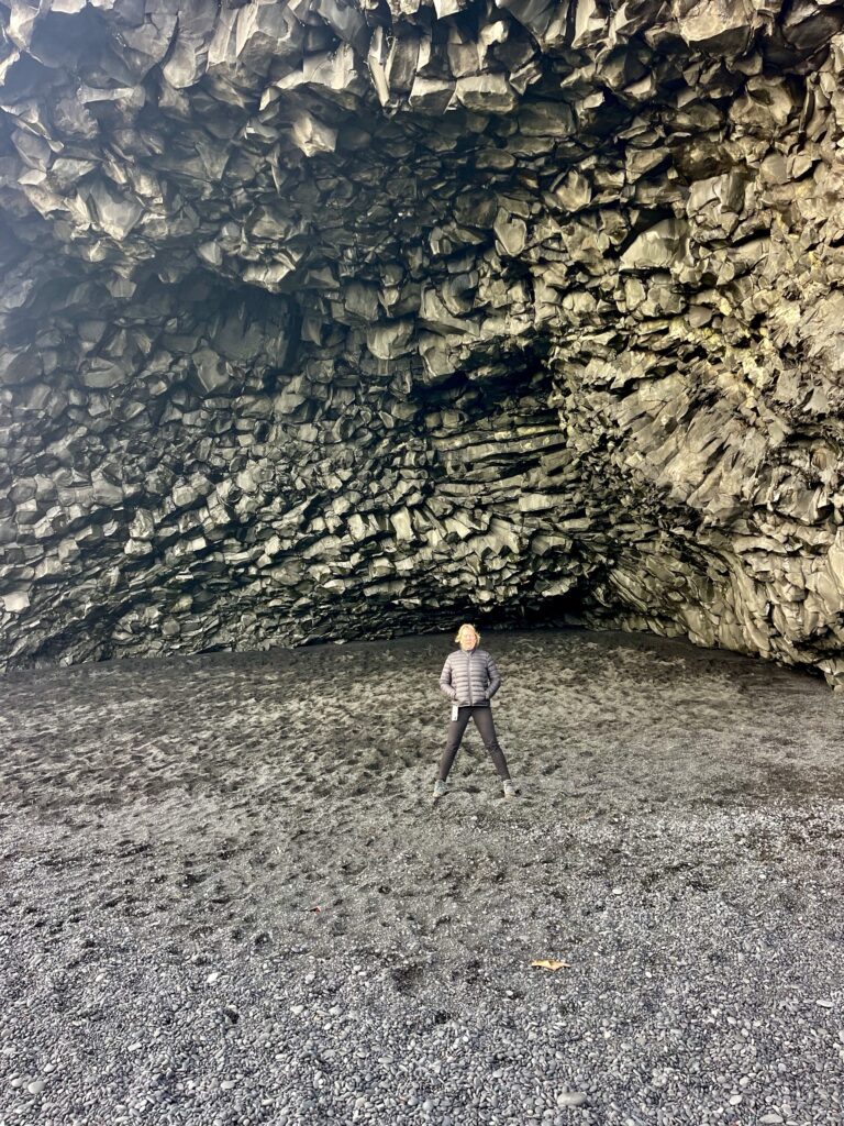
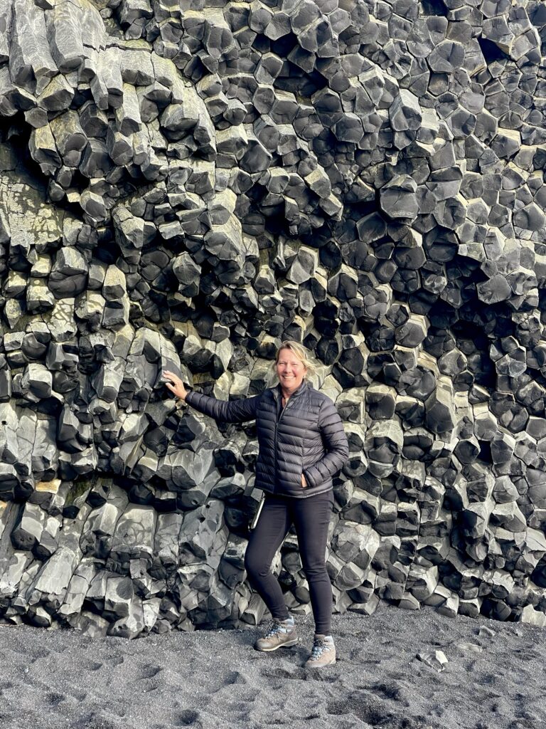
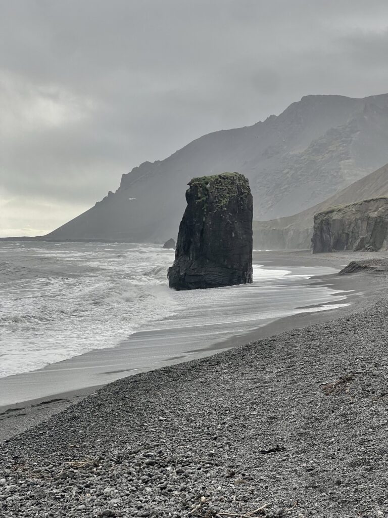
Back on the the ring road, the next stop was at Black Beach, a large black sand beach, known for its wild unexpected waves (a couple of tourists have already been sucked into the ocean and drowned), but also the amazingly beautiful basalt rock formations, which look like church organs. These are the popular Instagram locations of Icelands, where you see hundreds of Asian teens, often well dressed, posing on the beach and the rock formations, often causing damage and disturbing the peaceful and serene atmosphere of the location.

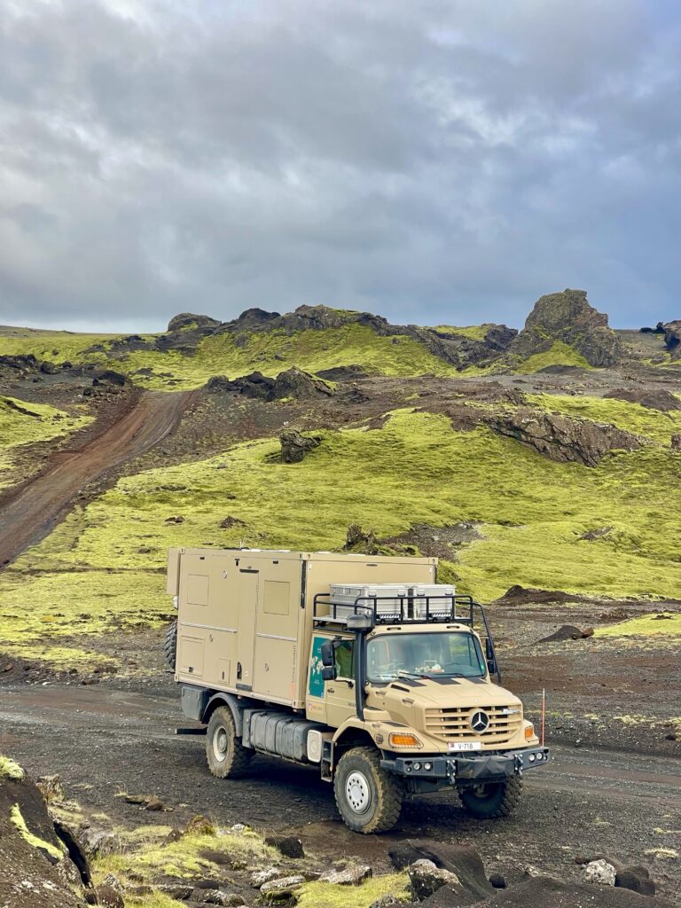
Our last Iceland wilderness route went through an area with small winding gravel roads, passing mountain ridges and a huge labyrinth of streams with melt water. From high above a cliff, with the sun hanging low, the sun light reflected in the running waters, like a large glowing blood vessel system. Like a carefully carved piece of art, telling the story of the declining icecap. A proper name would be “The Tears of the Icecap”.

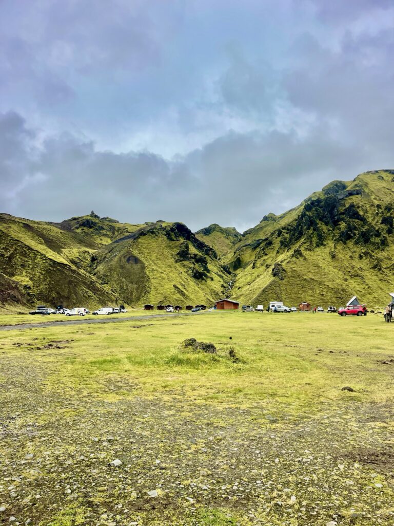
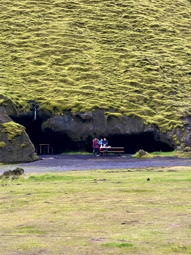
Tucked in the corner of a valley at the end of the road we had followed, was a large camp ground. We found many campers there already. Since it started to rain, the ground became soggy and most of the campers stayed in their vans, trucks or tents. A large cave facing the campground was used as a communal dining area, romantically lit with candles. A large wood stove was suppose to heat this area, but it was not on. Some wood bricks were on a table, so I used them to light up the stove. A young girl who was traveling alone and was preparing her meal in the cave, appreciated the warmth now created in the cave, while outside the wind started to blow and the rain intensified. It became cozy in the cave!
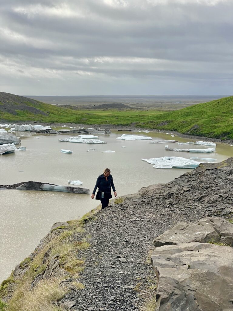
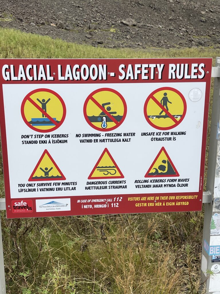
An interesting feature along the road is the many accessible glaciers, since the icecap is here the closest to the coastline. Some of them have glacier lakes, caused by the retreating glaciers, who leave a large dyke behind, where melt water accumulates. Small streams flow from these lakes, towards to ocean. The end of the glaciers are visible from the end of these lakes and large chunks of ice float in these lakes, when being dislodged from the glacier. Sometimes, these glaciers are too inviting to explore, not only by getting close to them, but even transfer them and use them as a gateway to cross the icecap. But that’s a very dangerous activity, because the numerous crevasses (cracks in the ice of glaciers), can be hidden by layers of soft snow. Once you fall in, you will never get out without special help. People have fallen into these crevasses and were never been found back alive. Only with enough experience and multi people together it is safe to cross a glacier or with a professional guide. One of the glaciers, a bit hidden from the main road, was used for organized guided glacier walks. 4×4 vans and jeeps brought large groups of visitors to the foot of the glacier, where the people received a safety helmet and spike soles (to be attached to the shoes). A large group of Chinese tourists just came down from the glacier, all chatting around packed in their colorful polar outfits, looking like they just did a tour in an entertainment park. Again, another once magical and really adventurous endeavor, turned into a mass tourism product. But, yeah, all in all, the glaciers are big money generators for Icelandic tourism.

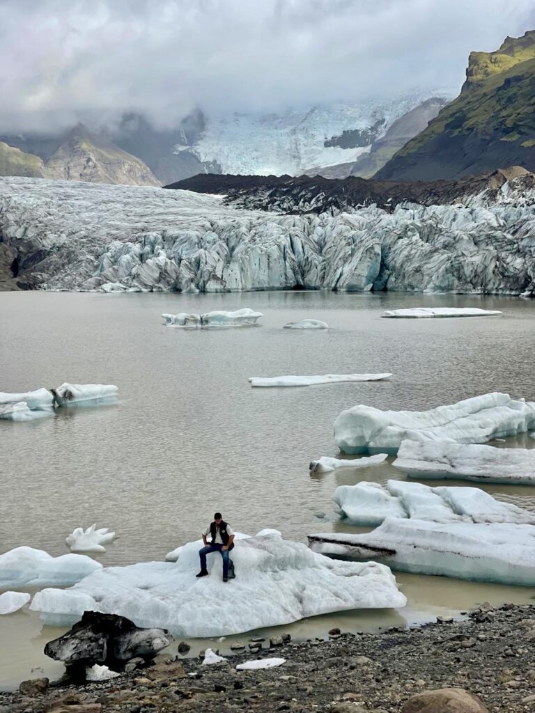
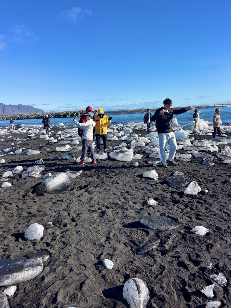
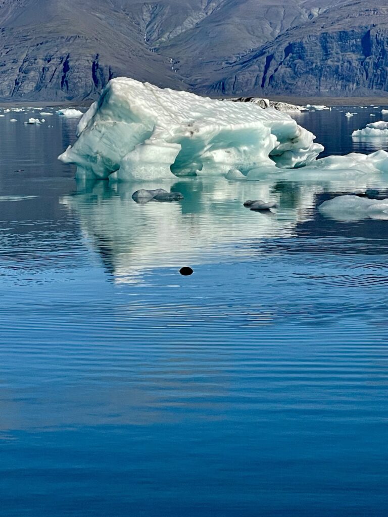
The famous Glacier Lake (the big one) is indeed very big and has as only one direct outlet into the ocean. Icebergs small and big are lining up like in a parade but ending up competing to be first to enter the salt open waters of the ocean, where they quickly disintegrate. Because of the ocean currents and winds, large pieces of ice are thrown back on the black sand beach, littering the beach with glittering diamond like big stones, hence the name of the beach “Diamond Beach”. Again here we found many influencers, “dancing” on the chunks of ice, like they are walking on diamonds.
Near the outlet a large visitors center has been built with a restaurant and a big terrace, from where you can watch the passing icebergs. You could also book a boat tour through the lake with an amphibious vehicle or do a guided kayak tour. The smaller lakes have organized Zodiac tours, passing along the edges of glaciers. Visitors are provided with thick thermosuites and life vests as if they are going on a polar expedition.


The large glacier lake is only visited by the boats and kayaks near the outlet, deeper into the lake and closer to the edge of the glacier there are no human activities. When we walked away from the crowed, following the shoreline of the lake, a curious seal stuck his head out of the water and followed us for a while. Seals are curious animals and in certain times and areas, that was/is their death sentence (hunting).
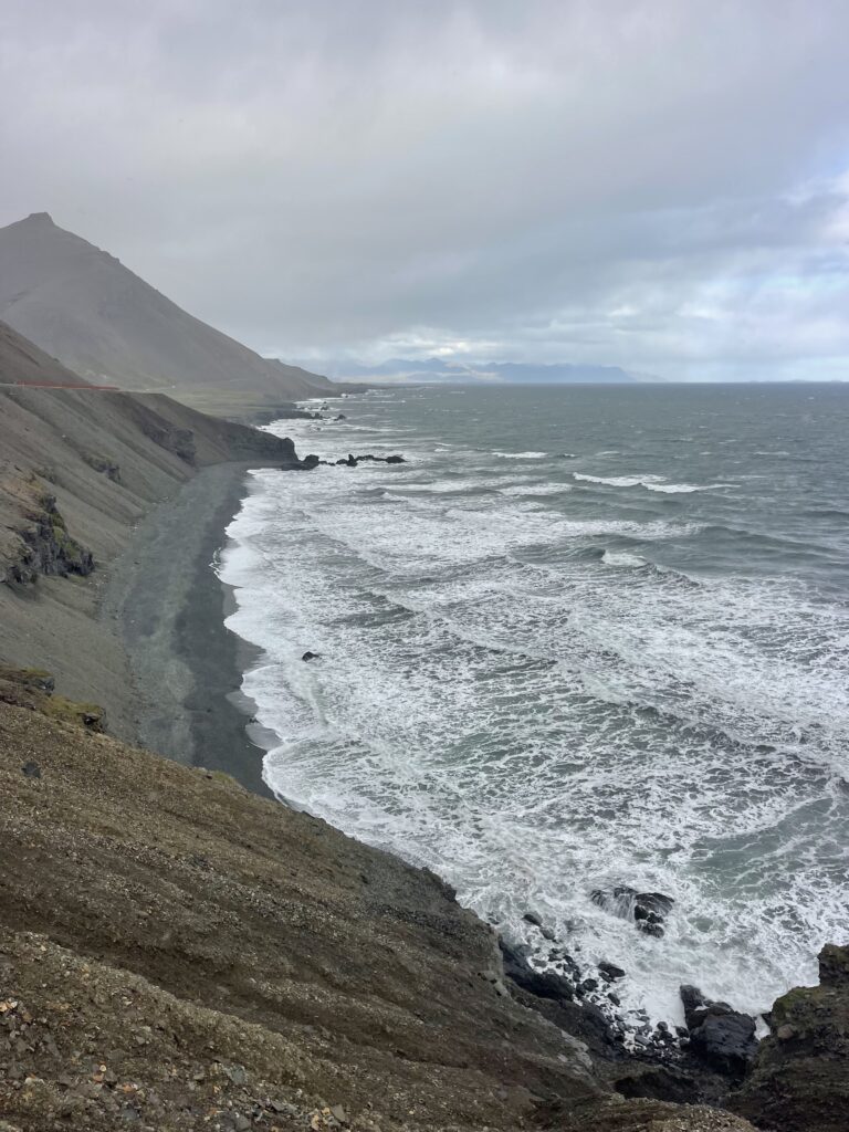
The large Glacier Lake and The Diamond Beach were the last main sites of the Golden Circle. From now on, most of the visitors would not continue, but drive back, to take a road east to visit places like The Geyser and other natural phenomenons. Where the Golden circle was an improved two way paved highway with two lane bridges, the continuation of the ring road, was less fancy. A bit smaller and with single lane bridges.
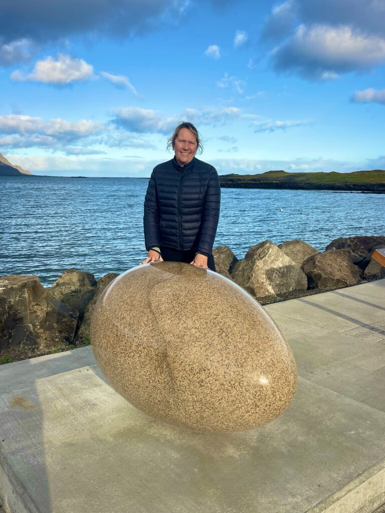
We made a few more stops like at a bakery along the highway, which was located, where one had the best view when that volcano with the difficult name (Eyjafjallajokull) in 2010 erupted and kept every single plane in Europe on the ground due to enormous ash clouds hanging over Western European. A small fishing town had an interesting art work, consisting of 34 large graniet sculpted eggs, dedicated to all 34 bird species in the eastern side of Iceland.
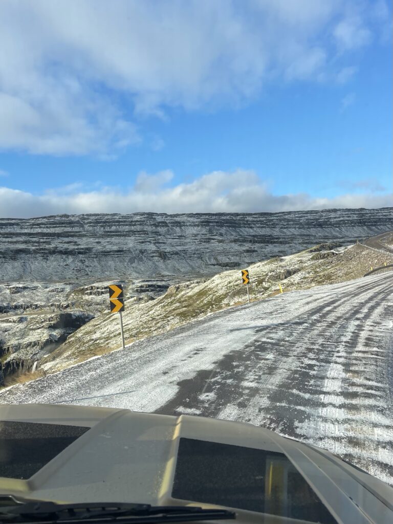
Our last night in Iceland, we parked high in the mountains, where for the last time the wind played with our truck, by shaking it through the night. As a goodbye to us, that night the first snow for the upcoming winter fell. It was strange but beautiful to see our surrounding the next morning, which had turned from green into white in just one night. The temperature also dropped significantly (but also because we were in the mountains). The road down was now a little slippery, but driving carefully and slowly, we came under the snow level, and the road more safe was to drive on.
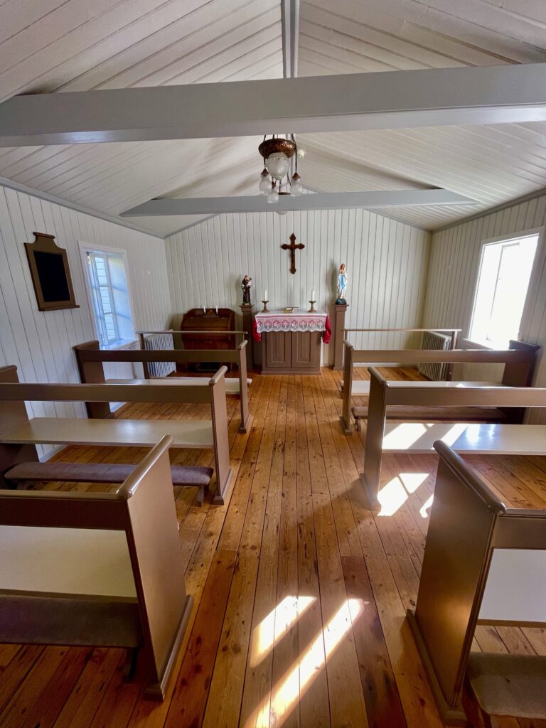
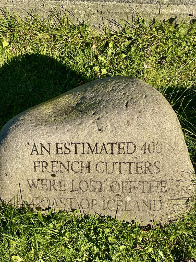
On the last stretch of the day towards the ferry harbor, we stopped and visited the town of Faskruosfjorour, often called the French town. In the late 1800s to early 1900s, the village it was, grew into a small town, due to the fact that it was a major hub for French cod fishers. Many streets have French names, a number of buildings show French architecture. In its hay days, a hospital, doctor’s house and church were built to serve the French fishing community. At its time, it was the best hospital for the whole of Iceland and the serving French doctor and nurses, lay the base for today’s medical care in Iceland. The three buildings have been restored to their former glory and are in use as a museum to highlight this piece of French-Icelandic history, and also as a hotel.


There was also French hospitals in Reykjavik and in the West Fjords, but these buildings are not there anymore. We were first aware of the French sailors, when we came across the French little white walled graveyard in the West Fjords. Learning about the history of the French fishing in Iceland is amazing. Two large fishing fleets left France each year, to fish cod on both west and east Iceland. One fleet came from Duinkerk (going to west Iceland) and one came from the small fishing town of Paimpol. In France, specially designed fishing boats were made for the cod fishing at Iceland, but they were not so big and because of their shape, not designed to batter high waves during storms. Thats why over 400 French fishing boats sunk around Iceland, either during storms or hitting the many rocky islands around Iceland when it was foggy.
Icelands rich fishing grounds have attracted multiple European countries to catch fish for their populations, as the fishing grounds closer to their home became depleted. Today, the fishing grounds have to be carefully managed to maintain a sustainable stock of fish, to make sure future generations can get their portion of fish as well.
Getting some last groceries in the town of Egilsstadir for during the trip on the ferry, we then reached Seydisfjordur, the ferry town. The town where we began our Iceland journey.
Iceland made a big impression on us. We were warned by others about a huge amount of tourists, no possibilities for wild camping, bad weather, unfriendly locals (tired of tourists), but we found the opposite in each of these pre-warnings.
Yes, there were a lot of other tourists, but they were mostly centered on and near the main road (N1). We could do wild camping almost everywhere (besides geographical difficult areas). Except for three days, the weather was good all the time. Often sunny and dry and not too cold. The Icelandic people we have met, were all friendly and when needed, extremely helpful.
Iceland attracts different types of visitors. Those who do a quick tour, to visit all the main highlights and can say “I visited Iceland”, those who want to show off on their social media platforms (the influencers) and those really loving the outdoor life in one of the last remaining wilderness of Europe, whether by back packing through the country side or using a 4×4 vehicle. The safe and secure feeling in Iceland contributes to its popularity (crime rate is very low). But also the fact that the south of Europe is getting too hot and is during summer time overrun by tourists, made more people going to the Nordic countries like Iceland. That is nowadays called a Coldcation.
For us it was the feeling of freedom, going without a plan, but with a fully equipped and stocked up truck, into the wild. Icelands interior with its unpaved roads and difficult tracks, where you are away from the crowds and civilization, was one of our favorite parts.
Overall Iceland told us a story. A story of real resilience! Where its people deal with earthquakes, volcanic eruptions, avalanches, erosion and floods, but are always prepared and work together to keep their society alive, functioning and advancing.
Iceland is magical, because of its raw nature and as the showcase for what mother earth is capable of. The layers of soft grey and green moss, covering the huge lava fields, volcanos and mountains, are both beautiful and ire, since it covers something what can be awaken any time.